[Hello]
︎About ︎Inroduction ︎Research Area[EXHIBITON]
[WALKING]
A series of walks I took around Klybeck
︎25.03 ︎31.03 ︎07.04 ︎18.04 ︎07.05 ︎14.05 ︎23.05 ︎16.06Then I wandered through the virtual space of klybeck
︎Virtual Klybeck[EXPLORING]
Some experiments at visualising urban space
︎Movement & Time︎Peripheral & Multi-Perspectival
︎Atmosphere & The Poetic Image
[SEEING]
I looked at the characteristics of the urban space.
︎Tactility, Movement & Time︎Details, Layering & Memory
︎Virtual & Unreal
[OTHER STUFF]
Other research, experiments thoughts and acivities
︎Workshop︎Bibliography
©Copyright 2019 | Tammy Demelier
Master of Arts in Visual Communication
and Iconic Research /FHNW IVK
Research Area
genius loci | ˈləʊsʌɪ, ˈlɒkiː | noun
the prevailing character or atmosphere of a place.
• the presiding god or spirit of a place.
This research has been approached as an outsider, allowing the space to reveal details and patterns that might be overlooked by those who walk the streets daily, and so I searched for an urban space[1]that was close but unfamiliar. As I researched areas, I came across rendered and somewhat unreal images of a large redevelopment project called Klybeckplus and became immediately interested in what the current lived experience of Klybeck was.
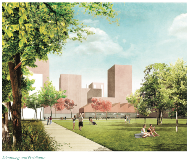

My research thus focuses on a portion of the neighbourhood of Klybeck in Basel, Switzerland. This area sits on the edge of the development project and so will not be changed physically but will be altered in extensive ways as the project moves forward and transportation and population patterns change. Many images have been generated of what is about to come or what could come in this future vision, a google search of the project turns up page after page of idealized, sanitized or politicized scenes of future urban life. These renderings all focus on a Klybeck that does not yet exist and generally does not show the people, the culture or the day to day street environment, activities and life of the community. In fact, many of the images are from an elevated view far above how the people would see it in real life (fig.1), or they show a very perfect and manicured experience.(fig 2) Images such as these are familiar to us as we have seen them in other developments all over the world. These renderings are intended to serve the interests of the investors and the others outside the community and present images tailored to their uses. Most interestingly, these visions of Klybeck do not include images of what is the current experience of living in the community day to day and it is from this point that I would like to begin my research.
What does a neighborhood in Klybeck look like from the street, from a non-idealized point of view?
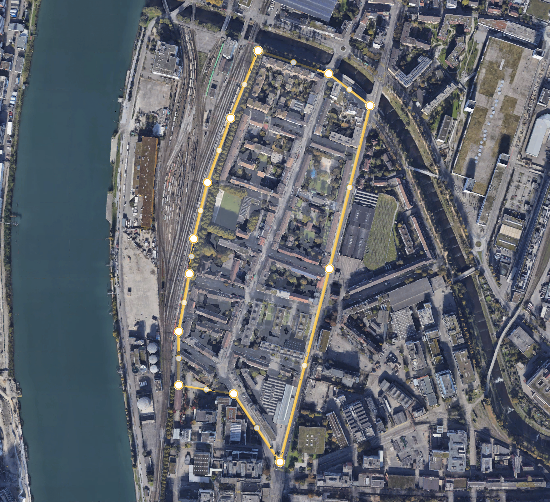
The area I will research covers about 2.12 kilometers and includes the following streets: Gärtnerstrasse, Klybeckstrasse, Inselstrasse, Schlossgasse, Kleinhüningerstrasse, Altrheinweg, Ackerstrasse, Holderstasse, Giessliweg Rastatterstrasse, and Weisendamm. It is essentially residential in nature, with small shops, schools and restaurants. It has some large housing projects and a robust immigrant community. Aove you can see the entire research area as viewed from above in Google Earth with a yellow line to indicate the boundaries. The future development area of Klybeckplus is located towards the bottom of the picture at the end of the research area.
︎You can explore the area here:
Figure l: Image from KlybeckPlus: Schlussbericht Testplanunng, 20. November 2018. P. 38. Retrieved from: https://klybeckplus.ch/wp-content/uploads/2019/01/Synthesebericht_final.pdf
Figure 2: Image from KlybeckPlus: Schlussbericht Testplanunng, 20. Novemner 2018. P. 37. Retrieved from: https://klybeckplus.ch/wp-content/uploads/2019/01/Synthesebericht_final.pdf
[1]Throughout this research I use the terms urban space and urban community interchangeably. I am aware that they carry different connotations and so, in general, when referring to generic or non-specific urban areas I will use the term space rather than community